An on-device vector topo that's offline for all 50 states — plus route planning, ride recording, fishing regs, and live river conditions. Built for ADV riders, overlanders, and dispersed campers by riders, not mapping professionals.
Coming to the App Store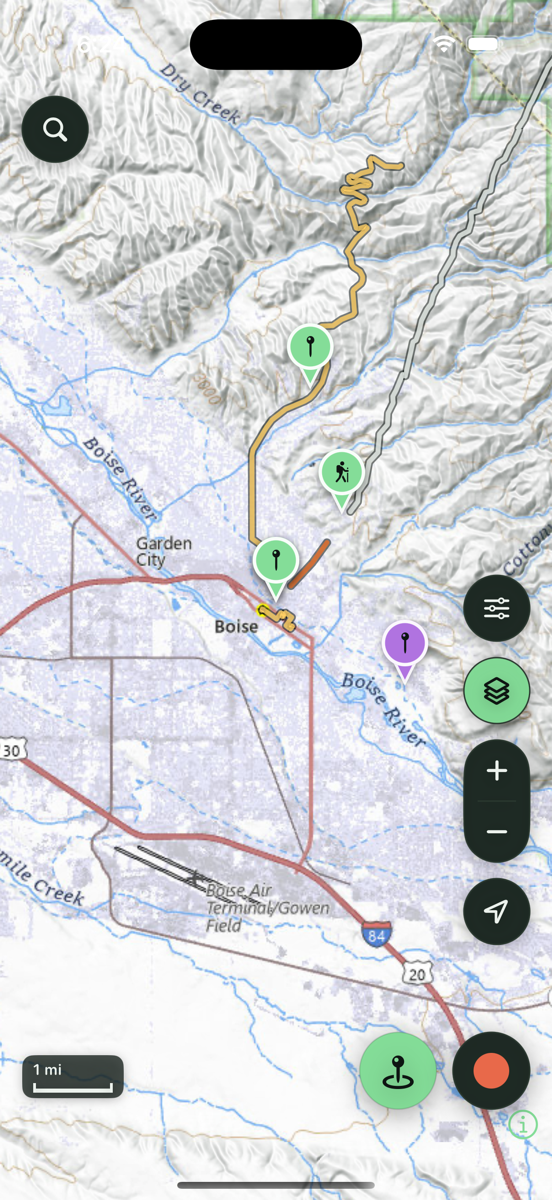
A vector topo built to live on your phone — contours, terrain, and public land — with the overlays that matter off-pavement: USFS roads, trails & MVUM, BLM parcels, water, and recreation sites.
Trailmark's default map is a sage vector topo that's crisp at every zoom and renders straight from your phone — no tiles to stream. Download any of the 50 states for full trail-level detail and contours that work in airplane mode. USGS topo and satellite are there too when you want them.
Per-layer opacity, drag to reorder, and one-tap Quick Sets for Overland · Moto/OHV · Hike. Tap any road, trail, or parcel to identify it — including who owns the land — and browse 14,000+ USFS campgrounds, trailheads, and day-use sites bundled in nationwide, no download.
Drop points and snap to the road-and-trail network, get the elevation profile automatically, then follow any saved line with off-route alerts that buzz before a wrong turn becomes ten miles.
Gloves on, moving, bad light — Trailmark is built for the moment, not the desk.
One tap at your GPS position, long-press anywhere on the map, or just ask Siri — hands on the bars. Add photos, notes, icons, and colors; get a multi-day forecast right on the waypoint.
Live stats on screen and on the Dynamic Island, pause/resume without phantom miles, then review distance, climb, moving time, top speed, and speed & elevation graphs.
Start a trip and every capture collects itself. End it, review everything in one place, keep what matters — and share the whole weekend as one file.
Trailmark reads the rules and the river so you don't have to dig through a PDF at the trailhead.
Tap a lake or river for seasons, limits, and special rules — 11 states and growing, straight from each state's own data. Family and recommended waters are flagged, and every water is searchable by name.
Live USGS river conditions nationwide — flow, stage, and temperature as a percent of normal, with a wading read, a fishability call, and 7-day to 1-year trend charts. A stale gauge says so.
Watch a water in Idaho and get a local notification when it's freshly stocked — checked in the background, no account, all on-device.
What's covered where: the map, offline state downloads, routing, place search, rec sites, and USGS river conditions all work across all 50 states. Fishing regulations currently cover 11 states — Georgia, Idaho, Iowa, Michigan, New Jersey, New Mexico, New York, Pennsylvania, Vermont, West Virginia, and Wisconsin — and are expanding; stocking alerts are Idaho for now.
Everything lives on your phone. Move it whenever you want.
There is no server. Your waypoints, tracks, and photos never leave your device unless you export them or turn on your own iCloud backup.
Export everything — waypoints, tracks, trips, photos, settings — as a single file, or keep a private iCloud backup in your own account. Restore it on a new phone and nothing is lost.
Import GPX, GeoJSON, KML, and KMZ — including your Gaia GPS library with colors, routes, and icons intact, and onX files too. Export standard GPX or KML your riding buddies can open in any app. UTM, DMS, or decimal — your call.
Paid once. No subscription. No account.
Built for the ride, not the renewal.
Trailmark ADV is a standalone app — it depends on no service we run, so it can't be turned off, rate-limited, or paywalled later.